An important factor to consider when developing land is the visual character of the development. Right-of-ways are a tool for development designers to use to help shape this character. Right-of-ways can also shape the design of the area in terms of personal travel and landscape, and how these support your desired methods of circulation for pedestrians, bicycles, and automobiles, as well as public transit.
Going beyond the structures and hardscape paving to include landscape is another important influence on visual character. Tall, leafy trees can create shade in the summer to make a sidewalk more walkable in the heat, while ground level bushes and grasses help to soften building facades and add natural color to a development.
For a development to exist, services (such as electricity, water, sanitary, storm, gas, internet, phone, etc.) must connect to each structure to allow them to function. This is often done within the earth below public circulation and branches off from the way of travel to support each structure.
Each of these items require land to be dedicated to the public and create right-of-ways (ROWs) that mark the extents of land given back to the city to promote public access to your development. ROWs cannot contain built structures, allowing that space to be available to support travel, but can contain landscaping such as trees. They can vary based on your development and character that is desired. Often these are created by offsetting the centerline of the desired right-of-way to create the elements that compose the right-of-way that is the total planned width of the traveled way.

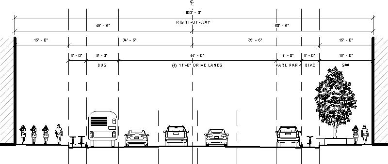
For example, a ROW in Downtown Denver may have one-way automobile travel, with parallel parking on one side and a designated bus lane on the other, protected bike lanes, and wide sidewalks with occasional planters between the sidewalk and the road to support planting of a tree or grasses.

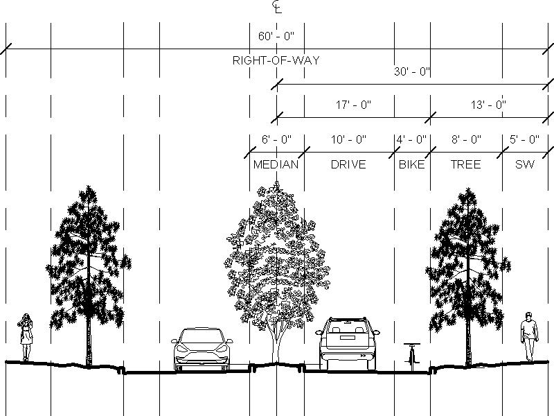
Another example is a street within a residential neighborhood that includes a landscaped median to divide multiple directions of travel, an attached bike lane and a detached sidewalk that provides a tree lawn between the road and pedestrians walking along the sidewalk.
These two right-of-ways create different environments that support different volumes of traffic and encourage different speeds of travel as well. The city promotes large volumes of traffic to move quickly with its many drive lanes and large protected pedestrian travel ways. The residential street encourages lower volumes of traffic to travel at slower pace as it brings modes of travel closer to each other and encourages everyone to look out for everyone else.
Right-of-ways are typically larger when larger volumes of traffic and services must move through them, and decrease in size as numbers of users and services shrink. Larger ROWs tend to occur in straight lines with large, sweeping curves to support travel at higher speeds, while smaller ROWs tend to curve and twist at smaller radiuses, requiring slower speeds to navigate.
It is important to understand right-of-ways and how they can impact your development’s character, ease and speed of travel through them, and their impact on your developable area of a parcel of land.


