Site and Project Planning for Magnetic North vs True North
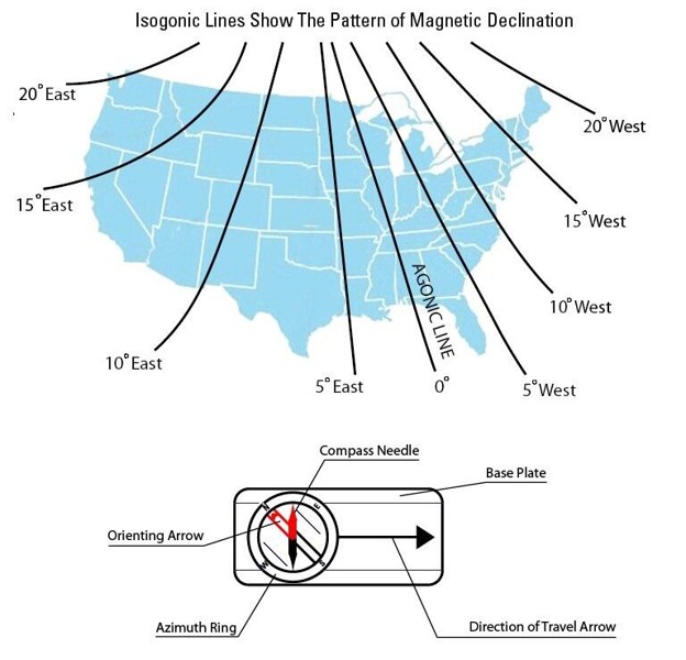
Imagine this: you buy a lot that you love with great views and plan to build a house. There are several distinct views that you would like to have framed through the intentional placement and alignment of several areas of that house. To ensure that the alignment is just right, you stand at the site with a compass and point it toward those views to “shoot a bearing” (the fancy word for finding the angular measurement from north) and you pass those bearings along to your architect. The architect designs your house using those bearings to create floor plans and intentional design elements that precisely align with the views. You build the house, move in, and realize that something is off! The views that were meticulously planned are all off by several degrees! The house is built, so you are stuck with this imperfection. Hopefully this will never happen to you, but it has happened (not at EVstudio, for the record) to many custom home owners. You might be scratching your head trying to figure out why this happened or how it could be avoided. The answer lies in a little geo-physical quirk of our planet which is that your trusty compass does not actually point toward true north. It points toward magnetic north which can be up to 20 degrees different from true north in the United States:
Even this image might not be entirely correct since both the north and south poles of our planet move drastically on a yearly basis. Here is a historical view of the pole location for Magnetic North:
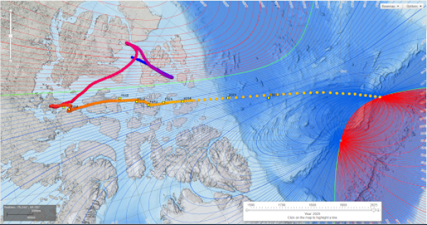
The most extreme difference in that map running left to right represents a shift in magnetic north of approximately 1,600 miles! Going beyond our human timescale, our planet has completely flipped poles approximately 540 times over the last 170 million years (University of Utah: When Earth’s magnetic field took its time flipping – @theU) as demonstrated by the polarity of geological rock layers containing magnetic elements.
The National Centers for Environmental Information have a really great map tool that shows how our planetary magnetic fields have shifted over the last 450 years: Historical Magnetic Declination Viewer
As an example, below are two images sitting at my desk at EVstudio: The first image has the Denver skyline approximately centered. The second image is rotated 20 degrees north.


See the problem? If this happened to your house, you might miss your views entirely! So, the question is “how can you prevent this from happening?”
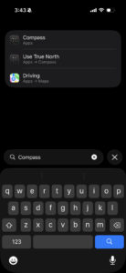
There are several answers to this question. The simplest being that since the magnetic pole location is a measurable distance and bearing from “true north,” databases are regularly updated to make the correction. Almost all design professionals such as surveyors, architects, and engineers have been trained to use “true north” data instead of magnetic north, so if you are providing bearings to your design team, make sure to specify if they were taken from true north or magnetic north from your location at a minimum. I recently ran across a survey for a project in New Hampshire that contained a note detailing that “bearings are based on a year 2000 magnetic observation.” Working through this example, I could see that the declination in the year 2000 was approximately 15.5 degrees west of north, whereas the current declination is closer to 13.5 degrees west of north. Going through the declination tables and then trying to apply that to your measurements can be tricky, but modern technology has made this relatively simple and available on your cellphone. Most phones (iPhone option shown below) give you the ability to change the way your compass utility works. By default most use magnetic north, so beware. You can change your compass to use true north by toggling it on in your phone settings. You will have to enable access to your location for the true north option to work correctly since the declination is dependent upon the date and exact location of the measurement:

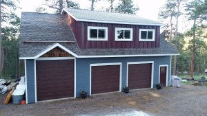
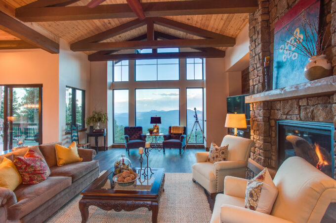
This is a photo from the Great Room of the first house I designed at EVstudio. The Great Room and the house were specifically positioned and designed to align to a view of Pike’s Peak 60 miles to the south:
Let us help you through this process to design your dream home!